

DIY Cartography: The Black Church as Community Anchor
A research-based map series investigating whether the presence of the Black church signals the presence and perpetuity of historically Black communities. (Spoiler: it doesn’t)
This series is part of a larger research project, “Squeezed Out: Mapping Diverse Dimensions of the Raleigh Housing Crisis.” The Raleigh housing crisis is explored through an ongoing effort of the graduate-level DIY Cartography course in the College of Design at North Carolina State University.

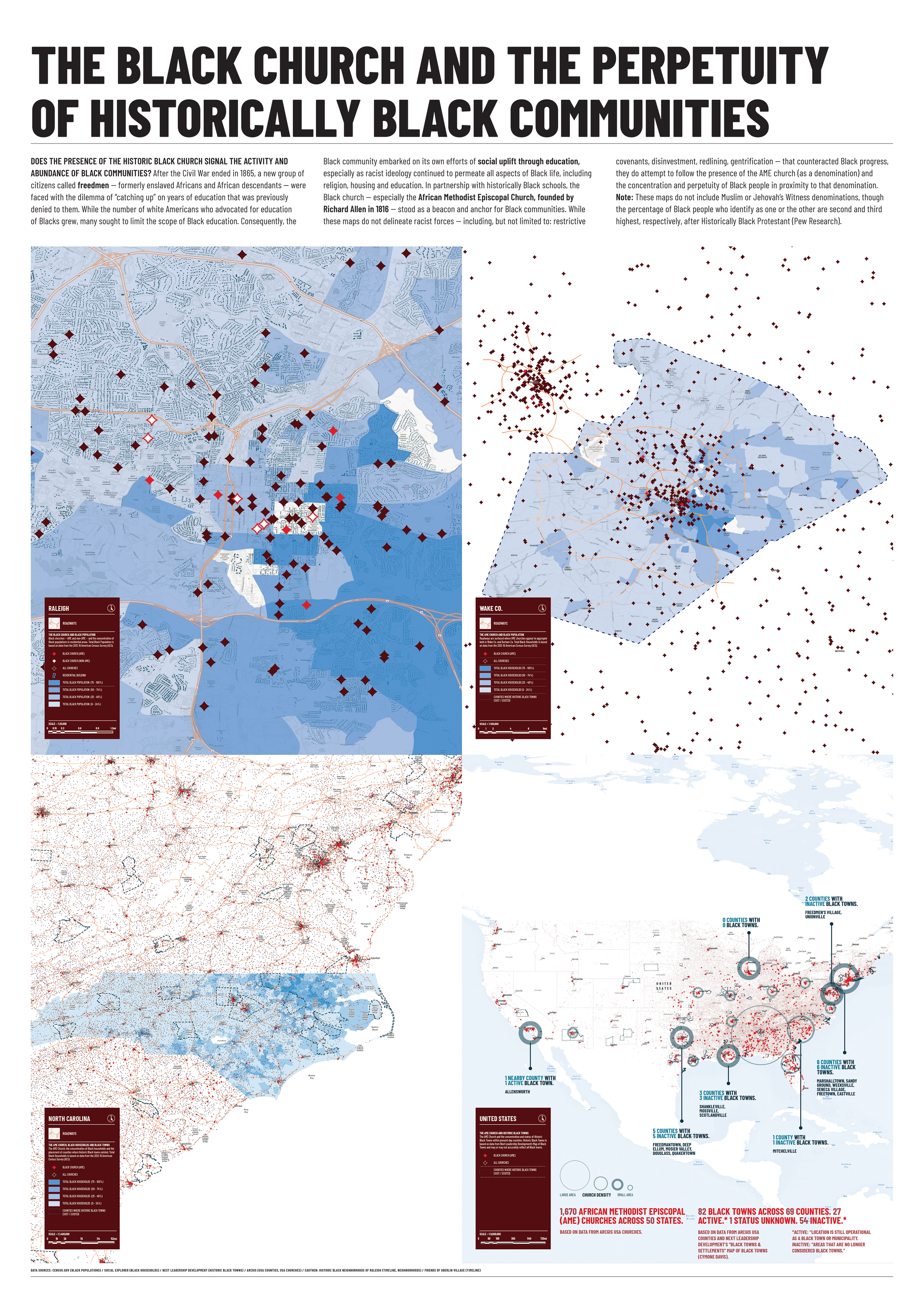
Map Series 1a: The Black Church and the Perpetuity of Historically Black Communities. Method: Geo-spatial.
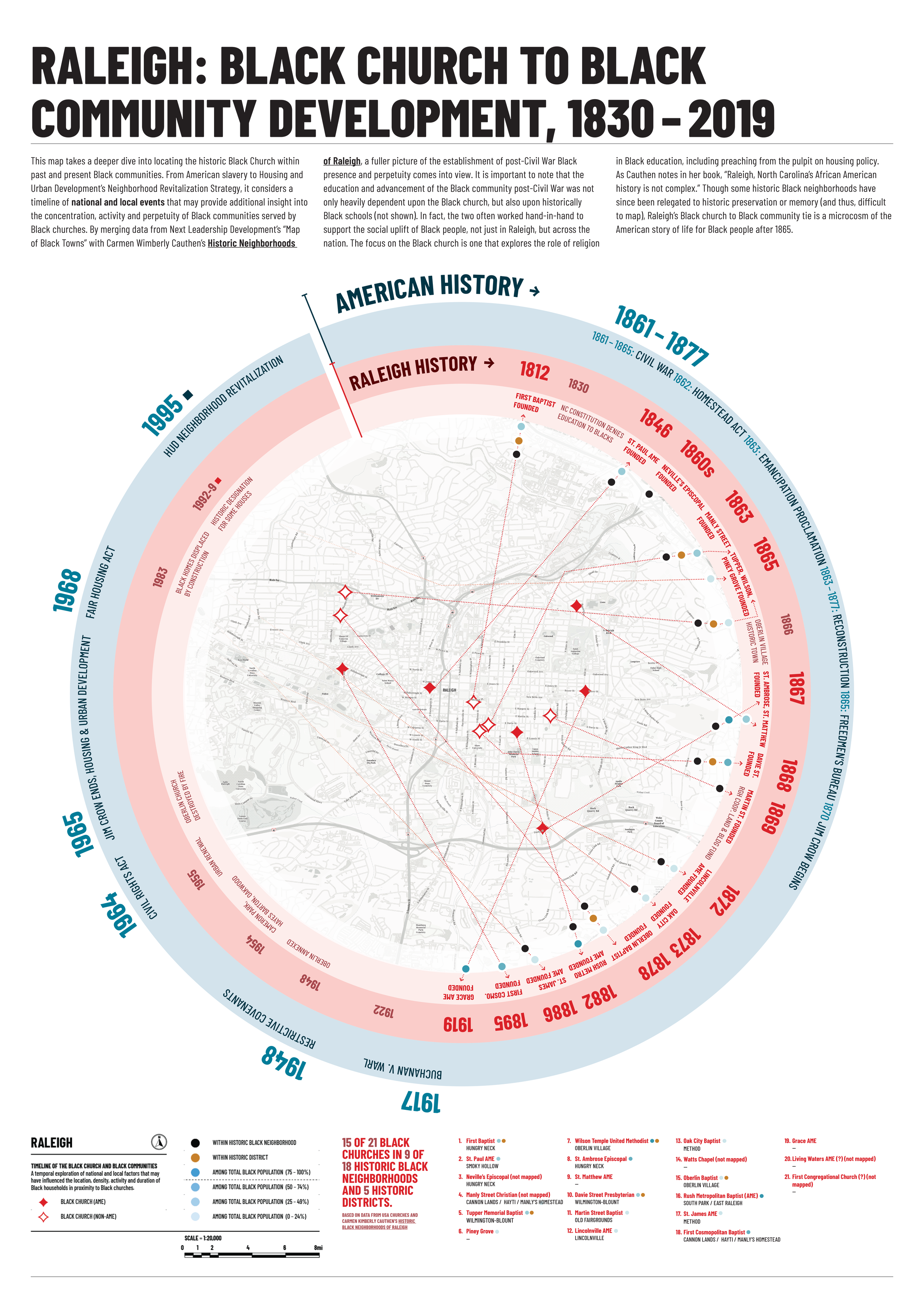
Map Series 01b: Raleigh: Black Church to Black Community Development, 1930-2019. Method: Spatio-temporal.
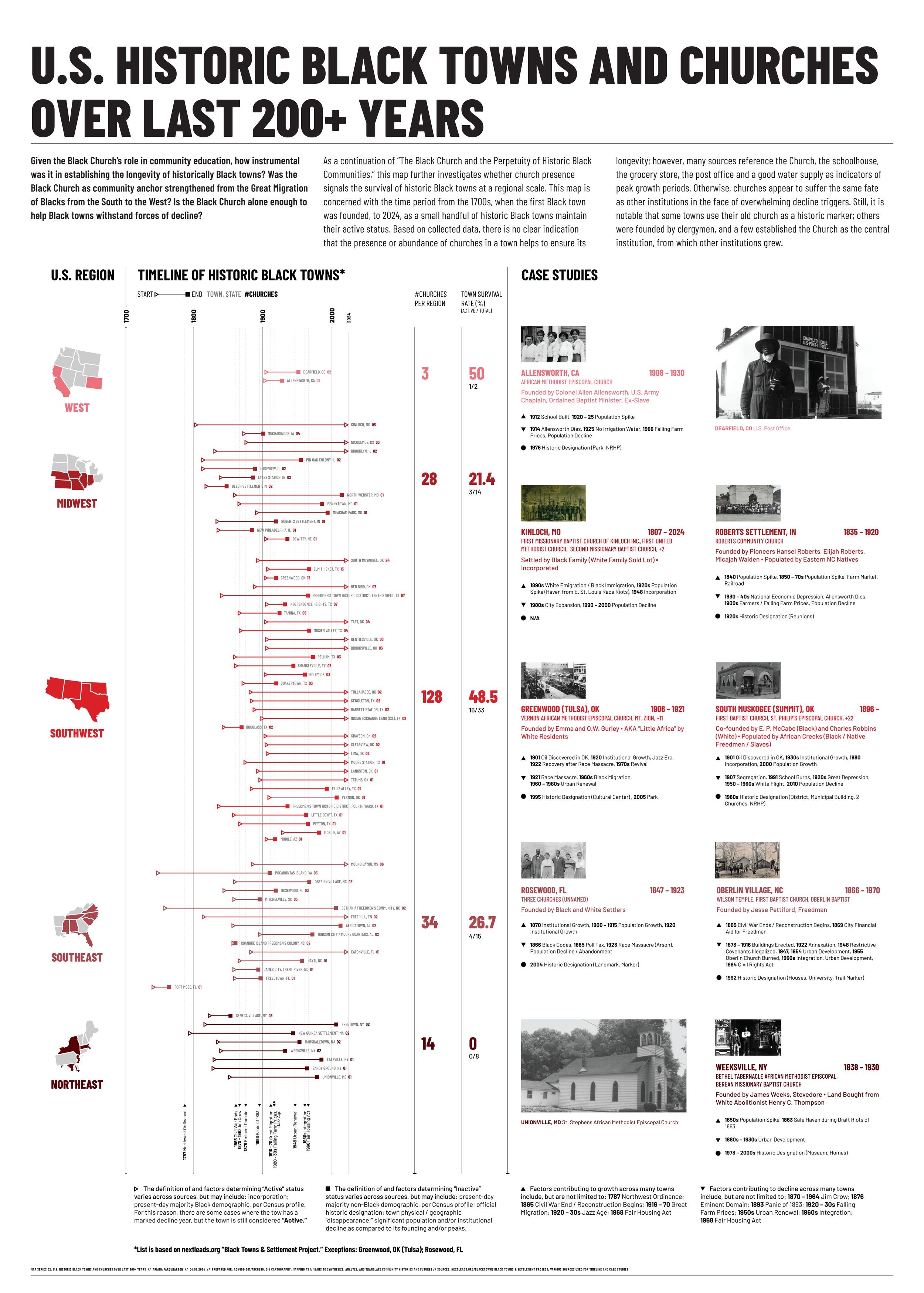
Map Series 2: U.S. Historic Black Towns and Churches Over Last 200+ Years. Method: Relational.
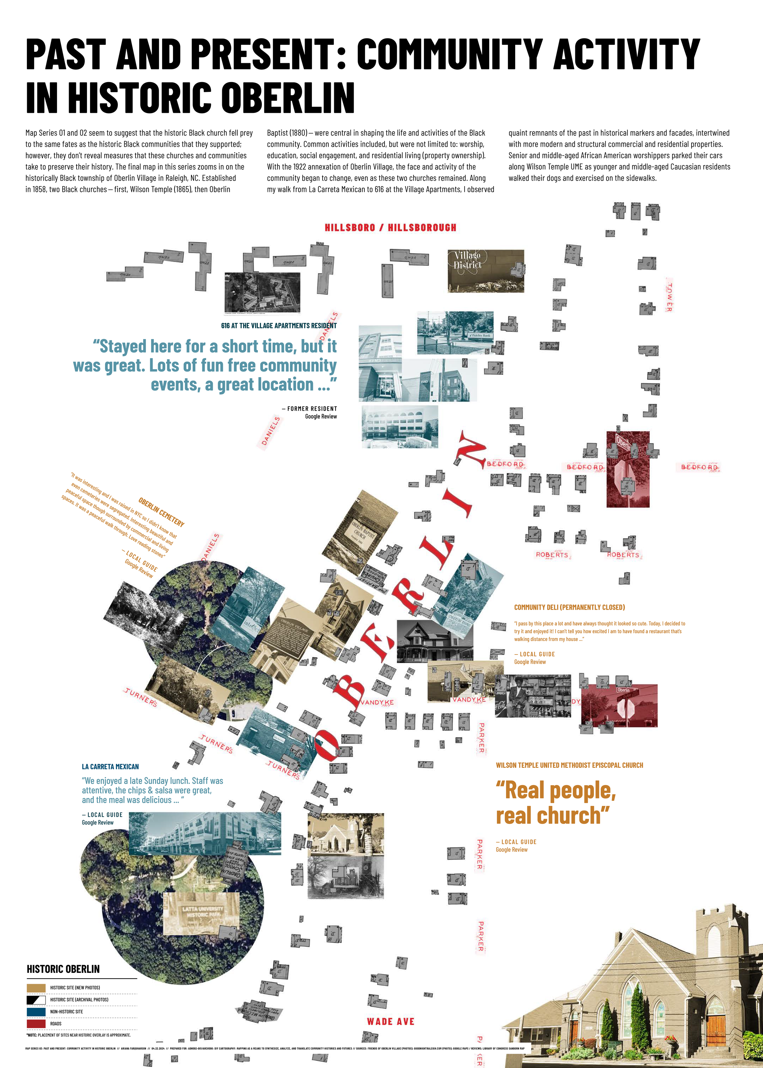
Map Series 3: Past and Present: Community Activity in Historic Oberlin. Method: Auto-graphic.
-
Essay
A Raleigh bus tour with designer and city planner Matt Tomasulo sparked my curiosity about restrictive covenants, estate property transfer, and other policies or practices that might impact the stamina of historically Black communities.
-

Presentation Script
After the Civil War ended in 1865, Black freedpeople experienced a sense of independence for the first time. Some stayed on Southern plantations; others ventured farther north and out west. But community worship was essential to racial uplift even before Emancipation.
-

Datasets
A collection of found and custom datasets, including: churches, population, footprints, Black towns. “Black towns” are loosely defined, given the difficulty in distinguishing between historic towns, communities and neighborhoods.